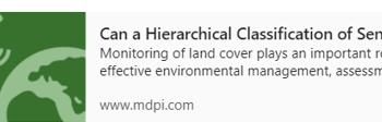
Category: News
The 1st publication from the InCoNaDa project
We are pleased to announce that the 1st publication from the InCoNaDa project was published: Waśniewski A., Hościło A., Chmielewska M.: Can a Hierarchical Classification of Sentinel-2 Data Improve Land Cover Mapping? Remote Sensing ,2022, 14, 989; https://doi.org/10.3390/rs14040989 Link to publication: https://www.mdpi.com/2072-4292/14/4/989.
1st InCoNaDa progress meeting in 2022
Christmas wishes
The 1st InCoNaDa international webinar (on-line), 6 December 2021
InCoNaDa at Conference of the Polish Spatial Society
The team from the Centre of Applied Geomatics at IGIK: Milena Chmielewska, Adam Waśniewski and Agata Hościło gave the presentation on “Comparative analysis of grasslands from the European Copernicus program against national reference data ” at the XXX Conference of the Polish Spatial Society: “Interdisciplinary role of geoinformation”. The conference was organised under the Honorary Patronage of the Ministry of Development and Technology, and took place on November 9-10, 2021.
57th ISOCARP World Planning Congress
We invite you to participate in the 57th ISOCARP World Planning Congress, where the Team from Łódź University of Technology: Dr Eng. Monika Cysek-Pawlak and PhD Candidate Jakub Misiak will give a presentation on “Spatial Planning Needs Towards Copernicus Land Monitoring Services”. The study has been conducted as part of…
First annual project meeting
Mayor of city of Łódź about InCoNaDa project
We achieved the first project milestones
We achieved the first project milestones: 1) Usefulness of Copernicus High Resolution Water&Wetness layer for biodiversity assessment, accurate delineation of wetland and assessment of agricultural landscapes, 2) Investigation of reporting obligations in the context of land cover LC, land use LU and changes LULUCF, 3) Analysis of urban and spatial planning needs towards…
The 1st publication from the InCoNaDa project

We are pleased to announce that the 1st publication from the InCoNaDa project was published: Waśniewski A., Hościło A., Chmielewska M.: Can a Hierarchical Classification of Sentinel-2 Data Improve Land Cover Mapping? Remote Sensing ,2022, 14, 989; https://doi.org/10.3390/rs14040989 Link to publication: https://www.mdpi.com/2072-4292/14/4/989.
1st InCoNaDa progress meeting in 2022
Christmas wishes
The 1st InCoNaDa international webinar (on-line), 6 December 2021
InCoNaDa at Conference of the Polish Spatial Society

The team from the Centre of Applied Geomatics at IGIK: Milena Chmielewska, Adam Waśniewski and Agata Hościło gave the presentation on “Comparative analysis of grasslands from the European Copernicus program against national reference data ” at the XXX Conference of the Polish Spatial Society: “Interdisciplinary role of geoinformation”. The conference was organised under the Honorary Patronage of the Ministry of Development and Technology, and took place on November 9-10, 2021.
57th ISOCARP World Planning Congress

We invite you to participate in the 57th ISOCARP World Planning Congress, where the Team from Łódź University of Technology: Dr Eng. Monika Cysek-Pawlak and PhD Candidate Jakub Misiak will give a presentation on “Spatial Planning Needs Towards Copernicus Land Monitoring Services”. The study has been conducted as part of…
First annual project meeting
Mayor of city of Łódź about InCoNaDa project
We achieved the first project milestones

We achieved the first project milestones: 1) Usefulness of Copernicus High Resolution Water&Wetness layer for biodiversity assessment, accurate delineation of wetland and assessment of agricultural landscapes, 2) Investigation of reporting obligations in the context of land cover LC, land use LU and changes LULUCF, 3) Analysis of urban and spatial planning needs towards…