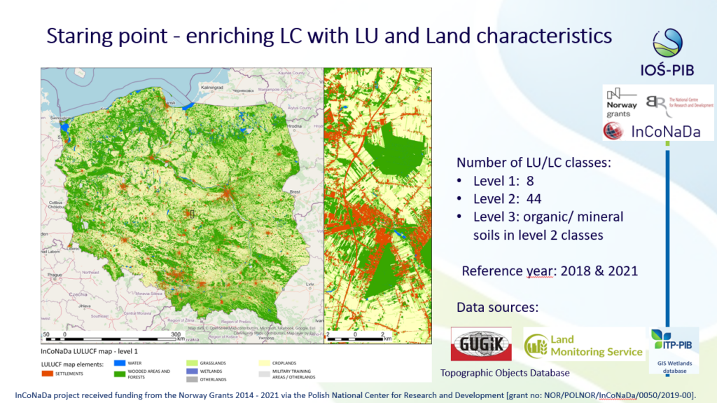
On 6–10 October 2025, Copenhagen hosted the second international conference on the use of Earth observation data for monitoring, reporting and verifying of carbon removal (EO4MRV). The event was organised by the European Environment Agency (EEA) and the European Space Agency (ESA). Experts from the Institute of Environmental Protection – National Research Institute IOŚ-PIB/KOBiZE: Agata Hościło and Marcin Żaczek presented the concept of monitoring land use changes in Poland, based on the integration of multi-source spatial data for the purposes of reporting greenhouse gas emissions and removals from the “Land use, land use change, and Forestry – LULUCF” sector. During the presentation, they presented a continuous land cover and land use map developed as part of the InCoNaDa project based on the integration of data from the Topographic Objects Database (BDOT10K) and products of the Copernicus Land Monitoring Service, which was the starting point for the further development of the concept of a land use change monitoring system for LULUCF purposes.